NASA has released two stunning panoramic images of the surface of Mars , taken by the Curiosity and Perseverance rovers. They are two of the most detailed and immersive visual depictions of the Red Planet to date. The images are not just a technological achievement, but also a scientific tool that reveals how geologically diverse the areas explored by each mission are.
According to the space agency, the new panoramas have been created from hundreds of individual shots, creating a full 360-degree image that allows scientists to study the Martian landscape and its evolution over time in unprecedented detail.
Perseverance reveals an ancient aquatic environment
The Perseverance panoramic mosaic was taken in an area known as “ Lac de Charmes ,” near the rim of Crater Jezero , where the rover landed in 2021. The image is based on 980 photographs collected between December 2025 and January 2026 and captures a particularly rugged but geologically rich environment .
See also: Japan's MMX mission ready for launch to Mars' moons
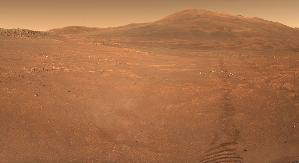
The Jezero area is considered one of the most promising places to search ancient microbial life, as scientists believe it was home to a lake and river delta. The layered rocks and scattered boulders act as natural archives that preserve information about the conditions at that time.
NASA describes the area as a "geological time capsule," as some rocks may have formed when the planet was still undergoing active geological and atmospheric evolution, under constant bombardment by asteroids.
Curiosity and the discovery of groundwater in Gale Crater
In stark contrast, Curiosity offers images from inside Gale Crater, where the rover continues its journey toward the slopes of Mount Sharp. The recent panorama consists of 1,031 images, taken over a month in late 2025.
The scene reveals a network of geological formations known as “boxwork structures,” which were created by the movement of groundwater through cracks in the bedrock. Over time, the minerals absorbed by the water resisted erosion, leaving behind a complex network of ridges.
See also: Giant geological structure on Mars strengthens evidence for ancient ocean
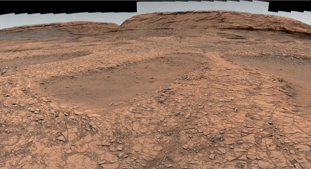
Curiosity, in its long-term mission approaching its second decade, has already found evidence of carbonate minerals, such as siderite, suggesting that Mars once had a thicker, carbon-dioxide. It has also detected organic molecules, some of the most complex ever recorded on the planet.
Two rovers, one planet – the geological contrast of Mars
Although the two rovers are about 3,775 kilometers apart, the new images bring them virtually "side by side" on a scientific level. One examines ancient surface lakes, while the other studies underground water systems that shaped the subsurface.
NASA says this contrast reveals “two sides of Mars”: a planet that once had an active water cycle both on the surface and below it. Comparing the two landscapes helps scientists understand Mars’ transition from a wet and potentially habitable world to a cold and dry environment.
The scientific value of high-resolution panoramas
Beyond their impressive aesthetics, the panoramas function as crucial scientific data. Each image incorporates information about the composition of the rocks, the historical presence of water, and the geological processes that shaped the surface.
Researchers are using this data to reconstruct a geological timeline of Mars, where each layer of rock corresponds to a different era of planetary evolution.
See also: Exploring the oldest craters on Mars
The next chapter of exploration
As Curiosity continues its climb up Mount Sharp and Perseverance expands its exploration to the rim of Jezero, NASA expects even more high-resolution panoramas in the future.
Each new shot is not just an image, but another piece in the puzzle of the history of Mars. A puzzle that may finally answer the most fundamental question: was there ever life on the Red Planet?