

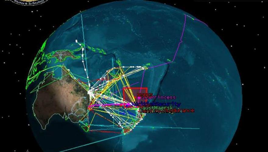
The issue of flight and ship safety has been brought back into the spotlight following incidents such as the disappearance of the Malaysia Airlines, the loss of the AirAsia plane, the Norman Atlantic incident, and the shooting down of the second Malaysia Airlines plane in Ukraine. It is in this context that researchers at the University of Leicester are developing a satellite-based system that would significantly reduce the size of search zones for missing ships and planes.
The concept uses satellite technology already in orbit to capture images of the sea, and allows the tracking of ship and aircraft movements with much greater precision than is currently possible. As the university's announcement emphasizes, the system could have significantly helped the search for flight MH370.
The project is a collaboration between the university, the New Zealand Defence Technology Agency and DMC International Imaging. A preliminary study published in the International Journal of Remote Sensing suggests 54 satellites with 85 sensors, which currently only capture images of land areas, but could also be used to observe the seas, as well as lakes and rivers.
Researchers estimate that regularly updated photographs of the seas from these satellites could allow the areas where searches for missing vessels are conducted to be narrowed to a few hundred square miles, thereby reducing search and rescue times and increasing the chances of locating survivors.
UNIVERSITY OF LEICESTER
"If you are on the open ocean and you encounter problems, especially in a small vessel, there is a significant possibility that you will be lost at sea. There is currently a major problem in monitoring small vessel maritime traffic, and this system could significantly improve the data perception/picture of vessel movements around the world, using existing technology.".
It is not a system that monitors the movements of vessels in the oceans in real time, like radar on aircraft, instead we propose a system that captures photos every time a satellite passes over specific points in the sea.
"If we are notified of a missing vessel, the images allow us to find its last known position. This would be very useful in narrowing down search zones and could reduce the time it takes to locate lost ships and aircraft, and hopefully their crews and passengers," explains Dr. Nigel Bannister, of the university's Department of Physics and Astronomy.
Tests are currently underway, using images from the NigeriaSat2 and UK-DMC2 satellites.
Source: defencenet.gr
📧
Subscribe to the SecNews Newsletter
