

Street View takes us a thousand miles off the coast of Australia, to the remote country of Vanuatu, an archipelago of 80 small islands, filled with lush jungle-like vegetation, pristine black-sand beaches, and nine volcanoes.

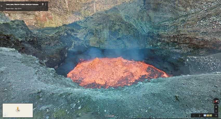
Starting today on Google Maps, you can “travel” to the edge of one of the world’s largest lava lakes , on the Vanuatuan island of Ambrym . Street View partnered with explorers Geoff Mackley and Chris Horsly, who ventured 400 meters into the active volcano’s Marum Crater with the Street View Trekker, collecting 360-degree photos of the molten lava lake, which is about the size of two football fields.
Ambrym is made up of 39 square miles of deserted volcanic caldera that is home to two active volcanic cones called Benbow and Marum. But the tropical island is also home to more than 7,000 people who live in the rainforest below the mountain. While the volcano has played a significant role in defining their history, due to unpredictable eruptions and its influence on agriculture and the environment, its inhabitants have learned to live in harmony with this beautiful but deadly natural phenomenon.
Moses, a chief in the local village of Endu explains, “We believe that the Marum and Benbow volcanoes are devils. If you go to a volcano you have to be very careful because the two volcanoes could get angry at any time. We believe that Benbow is the husband and Marum is the wife. Sometimes when they don’t agree there is an eruption which means their spirit is angry and that’s why we sacrifice a pig to the volcano.”.
As part of the Google Maps tour, Chief Moses invites you to take a walk through his village and hopes it will inspire you to visit this sacred place he calls home. After Cyclone Pam a few years ago, the country has rebuilt its infrastructure. Now Moses and his village are ready to welcome visitors back to Vanuatu, to experience its stunning beauty and learn about its cultural traditions.
